Wet & Wild for the Over Forties
- John Burkinshaw
- 1 day ago
- 6 min read
March 2025 - Now that the weather is improving I took the opportunity to plan a day out around North Knapdale. There were a few things I wanted to see and it would fill a whole day. Most of all, I was hoping to spot beavers in the wild. It had been on my list for a few years but all we had managed so far was to find some gnawed trees on a holiday in Devon by the River Otter. I had timed everything so that I could be at the beaver location for the two hours before sunset, which is supposed to be an active time for beavers.
It had been a lovely week, dry and calm with sunny spells, so I expected Saturday to be a day of basking in spring warmth, enjoying the peace of walking in the countryside whilst exploring new things. The weather had other ideas! I woke at 7am to an early start and a grey sky.
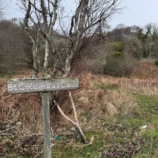
I caught the 8.30am ferry from Portavadie to Tarbert - the first of the day. I stood on the deck for a few minutes but it was cold and damp. From there I drove along many miles of beautiful single track road, where I passed no one at all, to St Columba's cave. Parking at a gravelly bay there is a very short path past the overgrown ruins of a small 13th-century chapel to a natural cave. This cave is traditionally said to have been a cell occupied for a time by St Columba on his way from his home in Ulster to his final settlements at Dunadd and Iona. The story goes that Columba applied to King Conal for permission to establish his monastery at Iona. While he waited for the king's decision, the saint stayed here, on the south coast of the Knapdale peninsula.
As I came out of the cave I felt the beginnings of drizzle.
Next was Kilmory Knap chapel, retracing my steps and driving along another 10 miles of single lane roads to get there. The rain was getting steadily worse and the wind was picking up too. The chapel of St Mary at Kilmory Knap is a surprisingly elaborate building for one which was never the parish church. It was probably built during the first half of the thirteenth century and passed out of use, probably after the Reformation. It now shelters the large collection of Early Christian stones and a series of late-medieval graveslabs and standing crosses of West Highland type, dating to the fourteenth, fifteenth and sixteenth centuries. The carved stones are absolutely beautiful and I stood and examined them whilst listening to the rain on the glass roof.

Wandering round the burial ground outside I was touched by the perfectly simple black gravestone with just a name and the word Mizpah on. "Mizpah" literally means "watchtower" in Hebrew. The phrase "May the Lord watch between me and thee" (Genesis 31:49) is associated with Mizpah, emphasizing God's role as a witness and protector of the covenant. Mizpah has evolved to represent the enduring emotional bond between people, even when they are physically apart. It's a symbol of remembrance, love, and commitment. Such a beautiful inscription that means so much.
Next to the church was a signpost to the beach. I set off walking in the chilly wind and rain, leaving my swimming kit in the car. Five minutes along I decided it wasn't so bad, and the water was calling me, so I went back to collect my swim bag. I squelched my way down the wet, muddy path but as I emerged onto the beach it was suddenly like a force 10 gale. The path must have been sheltered somehow. Once on the beach the smell of rotting seaweed was terrible and there was rubbish strewn about everywhere. I decided it wasn't the best spot for a swim, not least because my clothes were likely to blown to the 4 corners of the beach if I left the bag unattended - funny in hindsight I expect...
Next stop was Arichonan clearance village. I put on my waterproof trousers this time, although the horse had kind of bolted already as my trousers were still wet from the beach walk. The waterproofs made walking more difficult and as I did my best to stride up the hill I was cursing the weather whilst the rain pelted my face and dripped down my neck. When I looked up there was a vision in tweed coat heading my way, with what can only be described as a matching tamoshanter. Far too stylish for the inclement weather!
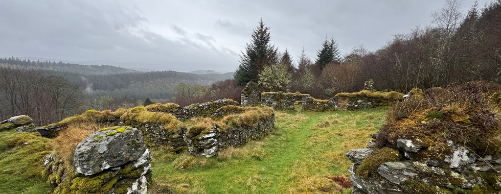
Arichonan means a shieling, or shepherd's hut, dedicated to St Conan. St Conan is another famous Irish saint and he’s the patron saint of this area. For more than two thousand years, shepherds built shielings - temporary summer hut - in the hills on sites like this, where families spent the summer letting their cattle graze. When the population outgrew the best fertile bottom land where it’s most desirable to live, families were forced into the hills permanently. Shielings turned into houses. Arichonan is shown on a 1654 map as a township - in the native Gaelic, a baile.
It seems there were six families at Arichonan in 1848, who like their ancestors, raised cattle, grew oats, barley and later, potatoes. These families were an intermarried and extend family group of MacLeans, MacDougalls, MacLellans, MacLachlans, Campbells and MacMillans.
Life here involved the men burning the surrounding oak wood for charcoal in brick ovens. The women and girls dyed wool fabric in a big communal stone boiler and sang ancient waulking songs as they pounded urine soaked tweed on a wooden table. The boys fattened their cattle and drove them to market in Falkirk. Everyone pitched in to plough the rigs in spring, and bring in the harvest in autumn.
The triangular vents in one of the buildings are characteristic of traditional Knapdale barns, and allowed the wind to blow through and gently winnow chaff from the barley.
On April 4, 1848, Neill Malcolm III, the landlord, served a notice to 40 of his tenant farmers. By the 27th May, it read, they were to “flit and remove themselves”. These village clearances happend all over Scotland at this time. Unfortunately the tenants here were not going to give in easily and riots ensued. Even the women took part, armed with frying pans and pitchforks. Neighbouring villages joined in and local law reinforcements were called by the landowners and it got violent. By 7th August most people had peaceably moved away, having held the landlord at bay for over 2 months. Those who caused the trouble were imprisoned at Inveraray jail for 4-8 months.
On the way back down to the car I decided I would call it a day early, after one more stop - this weather was not fun!
A few more minutes down the road is Dunadd fort. A fortified farmstead built 2,400 years ago developed into a prestigious fortress that was at the heart of the Gaelic kingdom of Dal Riata more than 1,300 years ago. It is one of the most important and evocative early medieval sites in Scotland. Dunadd became the vibrant heart of the first 'Scottish' kingdom and Kings of Dàl Riata ruled their kingdom from there. Their descendants became the first kings of Scotland and their people, called Scotti, became the first Scots. The language of the Gaels came to dominate much of Scotland. Gaelic is still spoken today and is recognised as one of our national languages. Diplomats, traders and royal refugees came here from across Western Europe. The discovery of precious metals and rare minerals, fine pottery and glassware reveals how well connected Dunadd was between the 500s and 800s AD.
I scrambled over the rocks carefully, very aware that I was the only person up there and if I fell and hit my head I might not be discovered until it stopped raining - could be weeks! When I finally found the inauguration stone my big feet did not fit into the carved out footprint. When kings of Dàl Riata were inaugurated by placing one foot in the footprint, they were betrothing themselves to the land that fed their people. In Ireland, where six such royal footprints are known, records claim that the stone recognises and proclaims the rightful king.
By this time I couldn't get much wetter (on the outside at least) and I was ready for home. The Knapdale beaver trail will just have to wait for another day!


Comentarios